
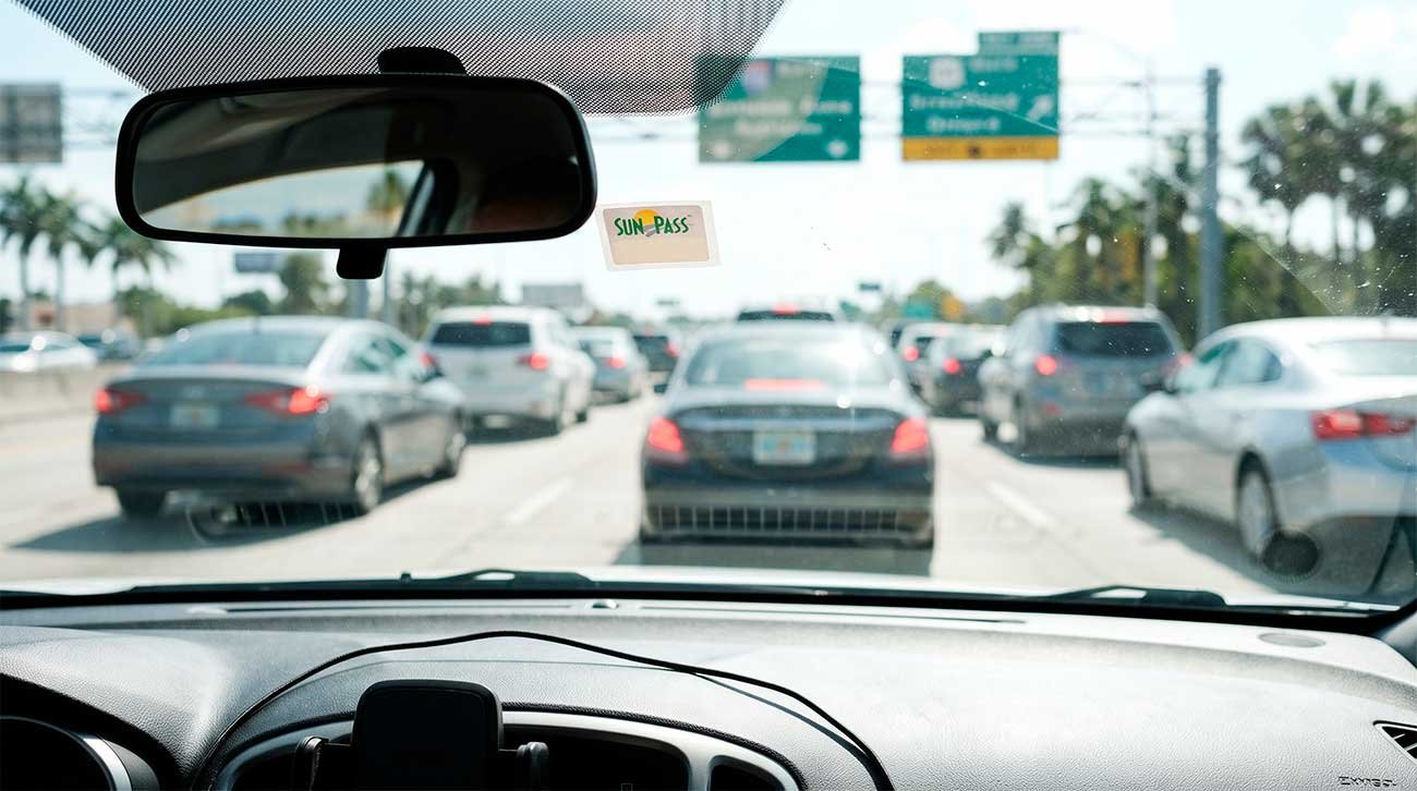
Bypassing Miami traffic requires timing major artery moves around strict rush-hour windows and avoiding single-lane bottleneck causeways. Commuter gridlock peaks heavily between 7:00 AM and 9:30 AM northbound and eastbound, and 4:30 PM to 7:00 PM southbound and westbound. Driving across key corridors like the MacArthur Causeway (A1A) to South Beach or the Dolphin Expressway (SR 836) near Miami International Airport during these intervals can triple standard transit times.
To travel efficiently across Greater Miami, driver tactics center on cluster routing—grouping daily destinations within single zones like Brickell, Wynwood, or Mid-Beach—rather than making multiple mainland-to-island crossings in one afternoon. Furthermore, skipping car rental toll-pass upgrades in favor of a personal SunPass avoids administrative daily surcharges on turnpikes and express lanes. When elevated freeways stall, shifting immediately to parallel arterial routes like Biscayne Boulevard (US-1) provides a functional bypass around major I-95 interchange bottlenecks.
If you rely blindly on standard GPS routing, you will quickly discover that miles mean nothing here; minutes are the only currency that matters. A 5-mile stretch in Brickell can easily devour 45 minutes during peak hours, while a 25-mile highway run might flow effortlessly at midnight. The city’s geography is choked by causeways, drawbridges, and narrow corridors, meaning that choosing the wrong route or timing your departure by even twenty minutes changes your entire day.
The Geography Lie: Why the Map Decisively Lies to You
When you look at a digital map of Miami before your trip, everything looks deceivingly close. You map out a morning in Wynwood, an afternoon in the Design District, and a quick evening hop over to South Beach, assuming you are just minutes away from your hotel. In practice, you are walking straight into a logistical trap.
Miami is structured around bottlenecks—narrow islands, drawbridges like the Brickell Avenue Bridge, and limited arterial connections to the mainland. A trip that looks like a straight line on a screen often forces you across a single span where a single stalled car or a marine opening stops traffic cold.
| Neighborhood Pairing | App Estimated Time | Real-World Peak Time | Main Bottleneck |
| Brickell to South Beach | 15 mins | 45–60 mins | MacArthur / Venetian Causeways |
| Downtown to Wynwood | 10 mins | 25–35 mins | Biscayne Blvd / I-95 off-ramps |
| Airport (MIA) to Brickell | 12 mins | 35–50 mins | 836 Eastbound / I-95 merge |
Failing to account for these realities means spending half your vacation trapped inside a rental car while burning through fuel and patience.
Anatomy of Miami Highways: Personalities and Pitfalls
Every major highway in Miami behaves with a distinct, unpredictable personality that GPS algorithms frequently misread. Understanding how these corridors function is the first step toward driving like a local.
I-95
Fast when it flows, but brutally volatile. Any minor fender-bender instantly brings the entire multi-lane corridor to a dead stop. The express lanes require a SunPass and use dynamic pricing that can spike heavily during high-demand windows, trapping you if you commit without checking your exit strategy.
Dolphin Expressway (SR 836)
Highly efficient late at night or early in the morning, but a nightmare heading east toward Downtown during the morning rush. The approach near Miami International Airport is plagued by weaving traffic, merging rental cars, and constant lane shifts.
Palmetto Expressway (SR 826)
Heavy commercial truck traffic and constant congestion dominate this outer loop nearly all day. Its complex multi-level interchanges make missing a split an instant 15-minute detour.
US-1 / Biscayne Boulevard
While not technically a high-speed freeway, these parallel surface arteries often keep moving when the elevated highways are completely gridlocked. Knowing when to drop down from the interstate to a surface boulevard saves serious time.
Tolls, Parking, and Rental Car Traps
The financial bleeding in Miami rarely stops at the cost of gas. Rental car companies routinely exploit visitors through automated toll-billing programs, charging steep daily administrative fees on top of standard toll costs just for driving past an electronic reader.
To bypass this trap, purchase a portable SunPass sticker at a local grocery store like Publix for a few dollars, register your rental plate via the app, and decline the agency’s daily package.
When you finally reach your destination, parking presents its own set of rules. Never guess where you can leave your vehicle. Municipal street parking relies heavily on apps like PayByPhone, where entering the wrong zone number or letting a session expire by five minutes invites a swift parking enforcement ticket or, worse, a costly tow. In dense zones like South Beach or Brickell, relying exclusively on high-priced hotel valet ($45 to $60 per night) drains your budget instantly. Smart drivers look for municipal parking garages on the perimeter of entertainment districts and complete the final stretch on foot or via local micro-mobility alternatives like the free neighborhood Trolleys or Freebee electric carts.
The Tourist Trap Scenario vs. The Smart Move Scenario
To see how logistics dictate your experience, consider two distinct approaches to a typical Miami day involving a beach morning and an urban dinner.
The Tourist Trap Scenario
You wake up at 9:00 AM in a suburban hotel far inland, jump onto the I-95 right into peak morning congestion, and head straight toward South Beach. You arrive an hour and a half later, burn twenty minutes hunting for an open street space, and finally surrender to a $50 garage valet. By noon, you are exhausted, frustrated, and already behind schedule.
The Smart Move Scenario
You structure your day by micro-regions. You stay closer to the urban core or travel against the heavy commuter flow, utilizing the Metromover or walking paths once parked. When moving between mainland neighborhoods like Wynwood and Midtown, you leave your car parked securely in a single garage, exploring the entire creative district on foot rather than restarting your engine for every single block.
How Do You Actually Beat Miami Gridlock?
The most effective way to avoid Miami traffic is to eliminate cross-town highway commuting during peak windows (7:00 AM–9:30 AM and 4:30 PM–7:00 PM) and embrace localized clustering. Group your daily activities within the same neighborhood block rather than driving across multiple causeways in a single day, and be prepared to drop off the interstate onto parallel surface avenues like Biscayne Boulevard the moment your navigation app flags an interstate slowdown.
Local Insights for Smarter Navigation
Observing daily traffic patterns across Miami reveals a few unwritten survival rules that keep locals sane:
Watch the Weather
Sudden afternoon tropical downpours instantly transform low-lying coastal streets like Brickell Bay Drive or parts of South Beach into shallow lakes. Driving a low-slung rental sedan through standing saltwater risks a ruined engine and a massive insurance headache.
Factor in Port Traffic
On days when multiple massive cruise ships dock or depart from PortMiami, the tunnel and surrounding downtown feeder streets lock up completely. Check the local cruise schedule before planning any afternoon meetings or dinner reservations near Bayside.
Master the Art of the U-Turn
Miami intersections feature dedicated dual left-turn lanes and frequent U-turn bays that allow you to reverse direction quickly without looping through complex residential blocks. Learning how to use them safely saves immense frustration when missing a turn.
Planning Your Movement Wisely
Ultimately, conquering Miami’s traffic is less about finding a secret hidden alleyway and more about respecting the physical scale of the city. Plan your accommodations around where you intend to spend most of your time, avoid crossing water bodies during peak rush hours, and treat every mile on the interstate with healthy skepticism. When you stop fighting the geography and start working with it, Miami transitions from an overwhelming concrete grid into a city you can actually navigate and enjoy.
Frequently Asked Questions
Is the I-95 Express Lane worth the price during rush hour?
It depends entirely on how aggressive the dynamic pricing is and how far you are traveling. If the toll spikes over $10 and your backup route is only showing a 10-minute delay, staying in the general lanes or dropping down to Biscayne Boulevard is usually the smarter financial choice.
What is the best way to handle tolls with a rental car in Florida?
Skip the rental agency’s expensive daily toll-processing packages. Buy a physical SunPass mini sticker at a local supermarket, set it up on your phone app using your rental license plate, and peel it off when you return the car.
Should I rent a car if I am staying entirely in South Beach and Brickell?
No. Having a car in these high-density pedestrian zones creates a massive financial burden due to exorbitant valet fees, sparse street parking, and constant congestion. You are much better off using rideshares, the Metromover, and walking.
How early should I leave for Miami International Airport (MIA) during the evening rush?
Double your navigation app’s estimated travel time if your route involves merging onto State Road 836 or I-95 southbound between 4:00 PM and 7:00 PM. Give yourself at least an extra 45 minutes of buffer time to account for sudden accidents near the airport terminals.